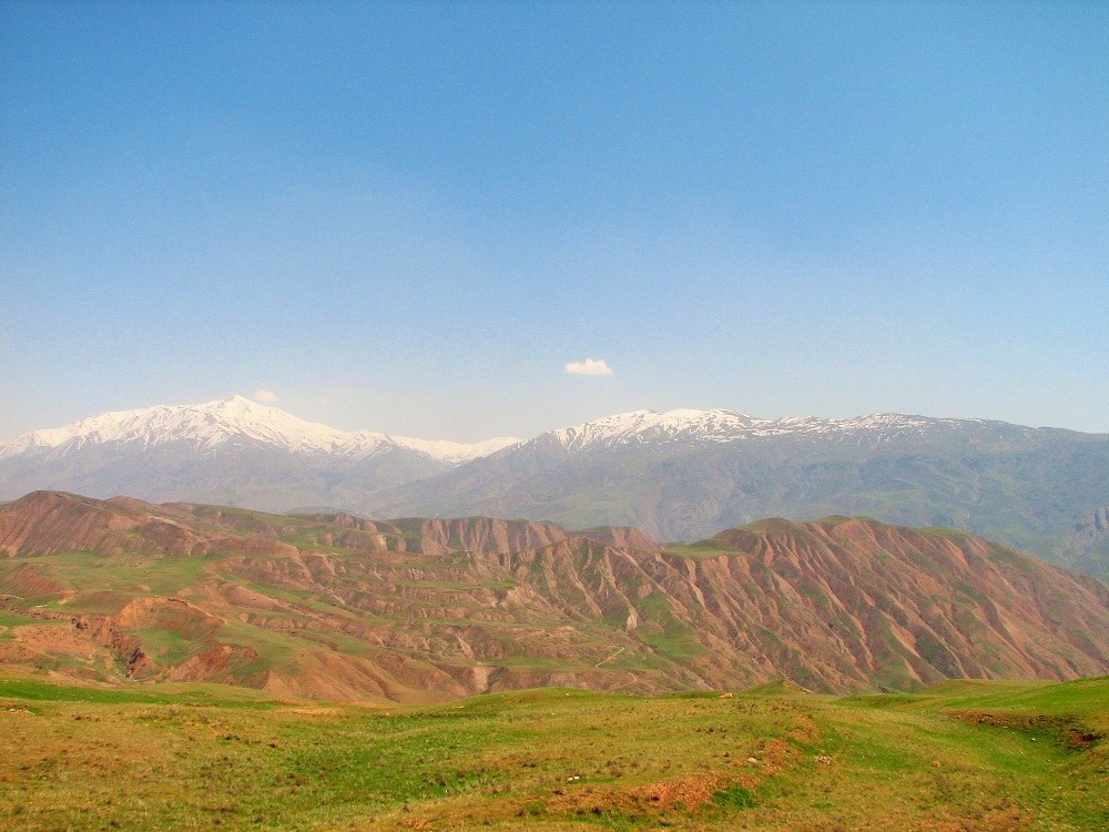
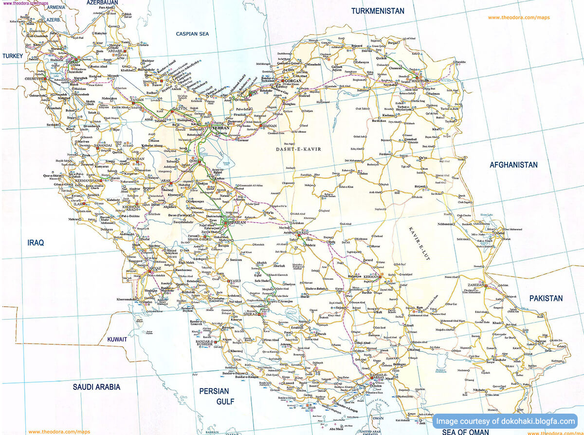
The whole area of Iran can be divided into four parts: 1/2 mountains as one part, and 1/4 deserts and 1/4 fertile plains as the other part. There are two major ranges of Mountains of Iran called the Alborz and the Zagros.
- The Alborz has been extended all the way from Azerbaijan to Afghanistan passing through the southern part of the Caspian Sea.
- The Zagros have covered a region from Azerbaijan to the west and SE of the country.
These two ranges function as walls blocking meteorological phenomena from entering central Iran. In addition to these ranges, there are mountainous regions in central and eastern Iran.
The Mountains of Iran at the North
Arasbaran Mountains at the NW of Iran are located along the banks of a border river, Aras, with the highest peak called “Neshan Kuh” 3700 m above sea level (ASL).
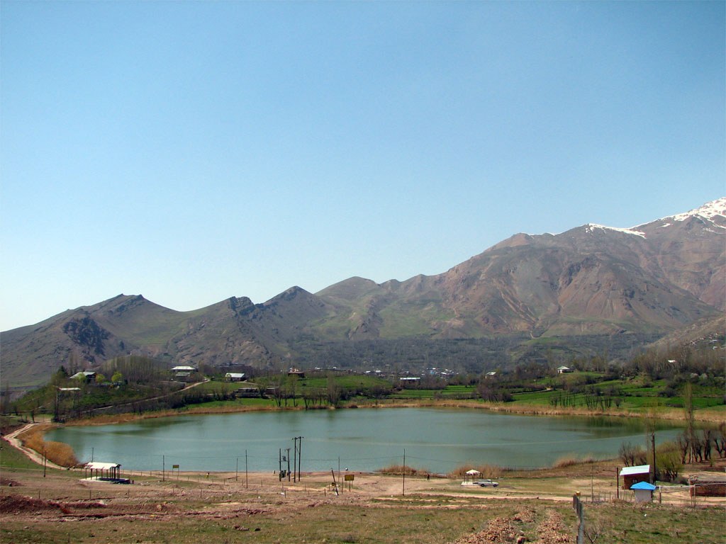
- Sahand Mountains are located at the NW of Iran with the highest peak 3710 m ASL.
- Sabalan Mountains are located in NW Iran with the highest peak 4811 m ASL.
- Talesh Mountains are located in the south of the Caspian Sea with their highest peak called “Aq Dagh”, 3200 m ASL.
The Alborz Massif
The highest and widest area within the Alborz is at central Alborz with the highest peak of Iran called “Damavand“, 5671m ASL. It is a burned-out volcano with a crater of 400m in width. At times, sulfur gas ascends to the top and covers the peak like clouds.
Khorasan Mountains
The Alborz extends to the NE of Iran and forms the Khorasan mountains. Khorasan Mountains can be subdivided into some smaller ranges. The northern range is extended from “Kopet Dagh” to a river called “Hari Rud”. The central range is around Bojnurd and Quchan, with their highest peak at the south of Quchan at 3520 m ASL, creating a marvelous view for the province. The southern range consists of some individual peaks with lower altitudes.
The Zagros Range
The peaks and altitudes of the Zagros have steep slopes, deep valleys, and very narrow gorges. The major altitudes of the North are border Mountains near Maku, Khoy, and Qotur.
The central Zagros consists of several peaks more than 3000 m ASL. The highest and wildest altitudes of the Zagros are Bakhtiary Mountains between Luristan and Shiraz plains.
Their highest peak “Zardkuh” is 4547 m ASL. “Dena“, another peak in Fars province, is 5200 m ASL. The altitude decreases as one goes southward.
The Mountains of Iran at the East
Extended from Khorasan to Sistan and Baluchestan provinces, there stand the Eastern Mountains of Iran which can be categorized into three major zones:
- “Jaam” in South Khorasan, is generally extended in the E-W direction.
- “Qaen ” to the south of “Jaam”, includes the “Ahangaran” peak, 2877 m ASL.
- “Makran” is extended from “Zabol” to “Bam Posht” in Sistan and Baluchestan province. The highest peak in this region is called “Taftan”, a burned-out volcano, which stands in the SE of Iran with an altitude of 4050 m ASL.
The Mountain Ranges in Central Iran
When it comes to the mountains of Iran in the central part, there are uninterrupted altitudes. Some of them are connected to the Alborz or the Zagros. They can mainly be categorized into “Qahrud” and “Banan” mountains. “Qahrud”, which is longer and higher, starts from around Kashan and the south of Tehran to Kerman. “Banan” is the continuation of the former one to “Makran” area in Sistan and Baluchestan province. At these ranges, “Shir kuh” near Yazd is 4075m ASL.
The central part of Iran is a very significant region as far as minerals are concerned. There is little rainfall during the year, sudden changes in weather, strong winds, and a few permanent rivers and flood-producing rivers in this region.
List of Mountains in Iran
1.Damavand
- Location: Alborz Mountain Range, northern Iran
- Elevation: 5,671 meters (18,606 feet)
- Peak Name: Damavand
2.Sabalan
- Location: Ardabil Province, northwest Iran
- Elevation: 4,811 meters (15,784 feet)
- Peak Name: Sabalan
3.Alam Kuh
- Location: Alborz Mountain Range, northern Iran
- Elevation: 4,848 meters (15,906 feet)
- Peak Name: Alam Kuh
4.Zard Kuh
- Location: Zagros Mountain Range, southwestern Iran
- Elevation: 4,548 meters (14,921 feet)
- Peak Name: Zard Kuh
5.Azad Kuh
- Location: Alborz Mountain Range, northern Iran
- Elevation: 4,445 meters (14,583 feet)
- Peak Name: Azad Kuh
6.Shir Kuh
- Location: Zagros Mountain Range, southern Iran
- Elevation: 4,050 meters (13,287 feet)
- Peak Name: Shir Kuh
7.Kuh-e Kamarband
- Location: Zagros Mountain Range, western Iran
- Elevation: 3,950 meters (12,959 feet)
- Peak Name: Kuh-e Kamarband
8.Kuh-e Shah
- Location: Zagros Mountain Range, western Iran
- Elevation: 3,809 meters (12,497 feet)
- Peak Name: Kuh-e Shah
9.Kuh-e Oshtoran
- Location: Zagros Mountain Range, western Iran
- Elevation: 3,794 meters (12,448 feet)
- Peak Name: Kuh-e Oshtoran
10.Mount Azadbar
- Location: Alborz Mountain Range, northern Iran
- Elevation: 4,137 meters (13,570 feet)
- Peak Name: Mount Azadbar
11.Mount Karkas
- Location: Zagros Mountain Range, central Iran
- Elevation: 3,889 meters (12,762 feet)
- Peak Name: Mount Karkas
12.Mount Alvand
- Location: Hamedan Province, western Iran
- Elevation: 3,580 meters (11,745 feet)
- Peak Name: Mount Alvand
13.Mount Sahand
- Location: East Azerbaijan Province, northwest Iran
- Elevation: 3,722 meters (12,211 feet)
- Peak Name: Mount Sahand
14.Mount Tangeh Savashi
- Location: Alborz Mountain Range, northern Iran
- Elevation: 3,601 meters (11,811 feet)
- Peak Name: Mount Tangeh Savashi
15.Mount Takht-e Soleyman
- Location: West Azerbaijan Province, northwest Iran
- Elevation: 3,319 meters (10,892 feet)
16.Mount Khwaja
- Location: Kerman Province, southeastern Iran
- Elevation: 3,319 meters (10,892 feet)
17.Mount Looleh
- Location: Mazandaran Province, northern Iran
- Elevation: 3,374 meters (11,070 feet)
18.Mount Dena
- Location: Zagros Mountain Range, southwestern Iran
- Elevation: 4,409 meters (14,465 feet)
19.Mount Sialan
- Location: Alborz Mountain Range, northern Iran
- Elevation: 4,127 meters (13,540 feet)
20.Mount Manir
- Location: Alborz Mountain Range, northern Iran
- Elevation: 4,125 meters (13,533 feet)
21.Mount Binalood
- Location: Razavi Khorasan Province, northeastern Iran
- Elevation: 3,425 meters (11,238 feet)
22.Mount Shemshak
- Location: Alborz Mountain Range, northern Iran
- Elevation: 3,430 meters (11,253 feet)
23.Mount Shirzah
- Location: Zagros Mountain Range, southwestern Iran
- Elevation: 4,230 meters (13,878 feet)
24.Mount Div Asiyab
- Location: Alborz Mountain Range, northern Iran
- Elevation: 3,350 meters (10,991 feet)
25.Mount Kuh-e Sabz
- Location: Zagros Mountain Range, southwestern Iran
- Elevation: 3,413 meters (11,194 feet)
26.Mount Bisoteun
- Location: Kermanshah Province, western Iran
- Elevation: 1,205 meters (3,953 feet)
27.Mount Izeh
- Location: Zagros Mountain Range, southwestern Iran
- Elevation: 3,252 meters (10,669 feet)
28.Mount Bazangan
- Location: Alborz Mountain Range, northern Iran
- Elevation: 3,245 meters (10,646 feet)
29.Mount Gol-e Zard
- Location: Fars Province, southern Iran
- Elevation: 4,367 meters (14,358 feet)
30.Mount Taleghan
- Location: Alborz Mountain Range, northern Iran
- Elevation: 3,163 meters (10,377 feet)



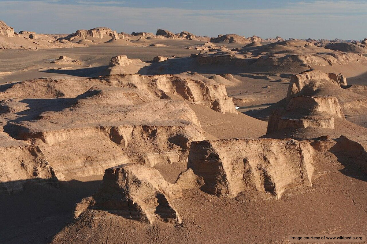
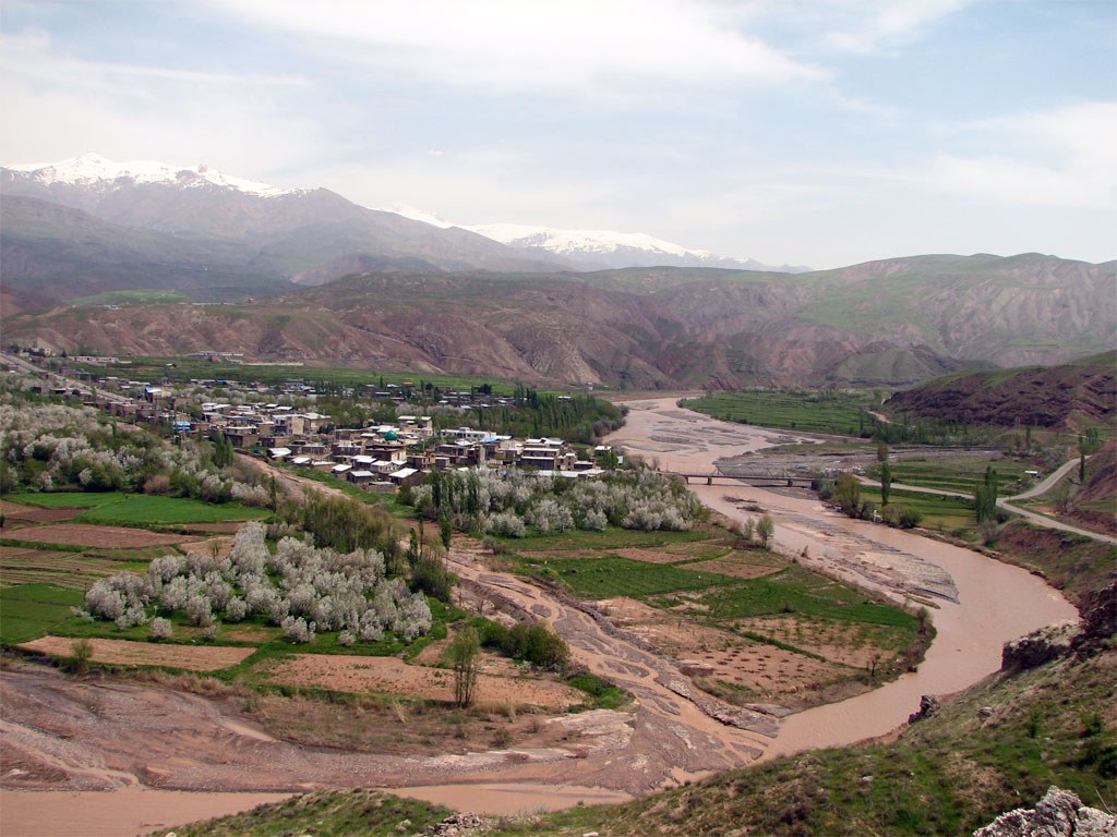

Hi Mr. Rahman Mehraby. It is very interesting finding a website like yours where you can inform about mountain ranges of Iran. Due to your great experience of touring across Iran, i have written to you for some help. I have been studying the Central Iran mountains and there is a place that i would like to locate. I got a single picture of this mountainous spot. In the picture you can see what looks like a part of a mountain ridge where there are deep canyons and some large faults at the foothills of this mountain ridge. In the background of this picture there are some jagged little peaks that look like a small mountain range. If you know a website or a bank of pictures of this region, i would appreciate a lot any information or help about it.
Hi Jose, Thanks for your message. I love mountains, but I’m more focused on monuments, history, and culture. Therefore, I recommend you to contact the people at “Irandeserts.com”. I hope they can help you.
Thank you very much Mr. Rahman Mehraby.