


The rivers of Iran make up a vastly extended network most of which seasonally is filled with water. Some permanent rivers run from the Alborz or the Zagros to the Caspian Sea, the Persian Gulf, and the Oman Sea.
Some temporary rivers either run into a body of water or get dried before reaching any watershed. Here are the watersheds of Iran and the rivers emptying into each of them:
Rivers of Iran Emptying in Caspian Sea Watershed
The Aras River runs for approximately 950 kilometers within Iran before reaching the Caspian Sea. It plays a crucial role in irrigating many areas, including the fertile Moghan Plain in the northwest of Iran. This river is vital for agriculture, providing water to a large number of farms and contributing to the region’s agricultural productivity.
The Sefid Rud is considered one of the longest rivers in Iran, with a length ranging from 600 to 780 kilometers, originating in the Kurdistan Mountains. It flows through the Gilan plain, which is known for its fertile lands. The river supports extensive fish farming, making it an essential resource for both agriculture and aquaculture in the region.
The Chalus River is another significant river in the north of Iran, particularly known for its role in fish farming. This river supports the local fish industry and contributes to the economy of the region by providing an excellent habitat for various fish species.
The Haraz River spans 150 kilometers, irrigating a large plain in Mazandaran province before emptying into the Caspian Sea. The river is renowned for its trout population, making it a popular spot for fishing and supporting local fish farming industries.
The Se Hezar River irrigates the Tonekabon plain. This river is essential for the agricultural activities in the region, providing the necessary water resources to support farming operations.
The Babol River is highly suitable for fish spawning and breeding. This river offers an ideal environment for aquatic life, contributing to the local fish farming industry and supporting biodiversity in the region.
The Talar River is 150 kilometers long and irrigates the Shirgah plain in Mazandaran province. This river is crucial for the agricultural landscape of the area, providing water for crops and local ecosystems.
The Tajan River stretches for 120 kilometers, passing by Sari, the capital of Mazandaran province. It provides essential water resources to the surrounding areas, supporting agriculture and sustaining local communities to the sea.
The Gorgan River is approximately 300 kilometers long, irrigating the Gorgan plain before reaching its watershed. This river is vital for the region’s agriculture, ensuring that the fertile lands of the Gorgan plain remain productive.
The Atrak River is 500 kilometers long but does not always reach Hosein Qoly Bay in Mazandaran province. The river’s flow can be inconsistent due to varying water contributions from other rivers, impacting its ability to reach its destination.
The Qarasu River is 80 kilometers long and originates from the east of Gorgan. This river provides necessary water resources for local agriculture and supports the surrounding ecosystems.
The Neka River is approximately 100 kilometers long and originates from Savad Kuh in Gorgan. It flows towards the Caspian Sea, supporting agricultural activities and providing water for the local communities along its path.
Rivers of Iran Emptying in The Persian Gulf & Oman Sea Watersheds
The Karun River is the longest in Iran, stretching approximately 850 kilometers. It plays a crucial role in irrigating vast areas in western Iran. The river is navigable and provides vital waterway access from December to June, which is the best time for navigation due to optimal water levels and flow conditions. The Karun River supports agriculture, industry, and transportation, making it an essential lifeline for the region.
The Zayandeh Rud (Zayandeh River) splits from the Karun River and flows eastward toward central Iran. Originating from the Zagros Mountains, it is one of the most significant rivers in the region, providing water for cities such as Esfahan. Despite facing challenges like water shortages, the Zayandeh Rud remains a crucial water source for irrigation and urban needs.
The Dez River is another major river in southwestern Iran. It joins the Karun River, contributing significantly to its volume. The Dez River originates in the Zagros Mountains and flows through the fertile plains of Khuzestan, supporting extensive agricultural activities and hydroelectric power generation.
The Jarahi River is formed by the confluence of the Zal and Marun rivers. It flows through Khuzestan province and eventually empties into the Karun River. The Jarahi River supports local agriculture and provides essential water resources for the surrounding communities.
The Zohreh River flows from the mountainous region of Kohkyluyeh in the north of Khuzestan province. It traverses the landscape, providing vital water resources for agriculture and local ecosystems before joining the Persian Gulf.
The Dalaki River originates from the Arzhan plain in Fars province. It flows southward and empties into the Persian Gulf near Bandar-e-Abbas. The river supports agriculture and provides water for the communities along its path.
The Mend River flows from the northwest of Shiraz and runs towards the Persian Gulf, near Bandar-e-Abbas. This river contributes to the agricultural productivity of the region and supports local ecosystems.
The Shur River empties into the Persian Gulf after flowing through marshy and sandy lands at the Strait of Hormuz. The river provides vital water resources for the surrounding environment and plays a role in the local hydrology.
The Minab River is formed by the confluence of the Rudan and Jaghin rivers. It flows towards the Persian Gulf, emptying north of the Strait of Hormuz. The Minab River supports agriculture, local communities, and ecosystems along its course.
The Mehran and Naband Rivers originate from the Larestan Mountains in the south of Fars province. They flow towards the Persian Gulf and empty near Bandar-e-Khamir. These rivers are crucial for the agricultural activities and water needs of the local populations.
The Haffar River, also known historically as the “excavated” river, was created during the early Islamic centuries by the Daylamite Buwayhid king, Panah Khusraw Adud ad-Dawlah. This canal was excavated to connect the Karun River to the Arvand Rud, significantly increasing the water flow and making it more reliably navigable. The Haffar River remains the main estuary of the Karun River, replacing the older Bahmanshir channel. The canal plays a crucial role in the water systems of southwestern Iran, enhancing both navigation and irrigation in the region.
The Bakhtiari River is a significant tributary of the Dez River in southwestern Iran. Originating in the Zagros mountains, the river flows through the rugged landscapes of the Bakhtiari tribal regions. It traverses through deep gorges and lush valleys, contributing to the Dez River, which ultimately merges with the Karun River. The Bakhtiari River is known for its stunning natural scenery and is a vital water source for the agricultural lands along its course. It also supports various small communities and provides opportunities for eco-tourism and nature exploration.
The Koohrang River originates in the Zagros mountains and merges with the Behestabad River to form the Karun River, the largest river in Iran by volume. The water from the Koohrang River is also diverted through a series of tunnels to the Zayandeh River, providing vital water resources to the Esfahan and Yazd provinces.
The Seimareh River flows through the picturesque landscapes of the Zagros mountains. It continues its course, contributing to local water systems and supporting agricultural activities. The Seimareh River eventually joins the larger Karkheh River, which then flows southward into the marshlands of Khuzestan before reaching the Persian Gulf.
Central & Lateral Watersheds
The following rivers of Iran empty into this watershed:
- “Uromiyeh” is the watershed for the following rivers: Zarineh Rud (240km long), Talkheh Rud (160km long), Simineh Rud, Safi Rud, and other minor rivers.
- “Masileh” at the east of Qom, is the watershed for the following rivers: Jajrud, Karaj, Shur, and Masileh.
- “Hoz-e-Soltan” & “Hoz-e-Mareh“, at NW of Masileh, are the watersheds for the following rivers: Masileh, Shur, and Hableh Rud.
Gav Khoony Marshland Watershed
“Gav khoony” marshland, at SE of Esfehan, is a 700km long watershed filled with water coming from Zayandeh Rud.
Central Fars Watersheds
There are three watersheds in this region:
- “Neyriz” (filled with the water coming from Kor river),
- “Maharlu” (filled with water coming from Qarabaq river,) and
- “Parishan” (filled with water coming from two springhead: Famur and Pol-e-Abgineh).
Hamun-e-Jazmurian Watershed
Halil Rud and Bampur are the two rivers emptying into this lake. The lake itself is situated in SE of Iran.
Kavir-e-Lut Watershed
This desert is a watershed into which some rivers of Iran empty. Also, some rivers subside and disappear into the ground before reaching their watershed. The rivers are:
Shur (permanent river), Shur Gaz, Tah Rud, Rud posht, Nesa, Rigan, Derakhtangan (a permanent river), Siraj, Andujerd, Joftan, Kahnoaj, Keshit, Pashooyeh, Nakhl Ab, Ab Khazan, and Chah Nely.
Dasht-e-Kavir Watershed
Most of the rivers emptying into this desert, which is also served as a watershed, are seasonal and subside into the ground before emptying into the pit. They are:
Kalimoor (500km long), Kal Shur (250km long), Hableh Rud, Damghan and Mojin.
Sistan Watershed
Only %40 of this large watershed is in Iran and the rest is in Afghanistan. It consists of several freshwater lakes that are a series of pits with no specific borders. The most well-known lakes in this region are “Hamun-e-Sistan”, “Hamun-e-Sabery” and “Hamun-e-poozak”.
When adequate rain falls, they get the main portion of water from a river called Hirmand originating from Afghanistan. It passes through 1200km of mountains and lower lands. Other minor rivers in the area are Farah Rud, Har Rud, and Khash from Afghanistan and Bandan and Shur from Iran emptying into Hirmand.
Namakzar Watershed
It is a pit north of Hamun-e-Sistan. Namakzar is a small lake getting water from all the rivers running from its western side.
Mashakal Watershed
Situated in the north of “Hamun-e-Sistan”, it gets water from these rivers: Mashakal, Simish and Rootak.
Qaraqom Watershed
It is situated at the NE of Iran inside Turkmenistan territory getting water from the following rivers:
Hari Rud (coming from Afghanistan, irrigating Sarakhs Oasis, and running to Qaraqom sand land) and other rivers joining it like Kashaf Rud, Jam, and Bakharz originating from Iran.
Therefore, although plenty of Iran rivers were introduced here, water has always been a vital issue. Many of the rivers of Iran contain salty water. Many of them are seasonal. This makes fresh drinkable water even more valuable.
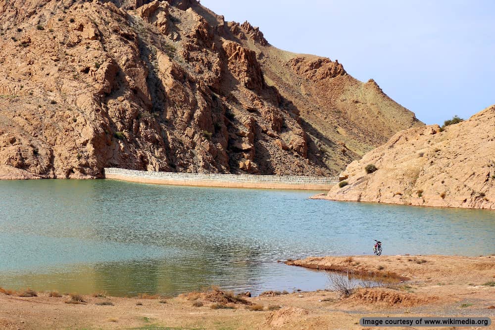
List of Iran River Dams
Iran is one of the top 5 countries in dam construction worldwide. They have constructed 172 domestic dams over the rivers of Iran. Over 600 projects are under construction and will be inaugurated in the future.
The Oldest Arch Dams in Iran
Dam construction in Iran dates back to the Ilkhanid period in 14th century CE. The following examples are considered historical attractions and are registered on the Iran National Heritage List.
The Kebar Dam is the oldest surviving example of a masonry arch dam in Iran built in 1300. This dam was constructed over the Kebar River in modern-day Qom province. Its purpose was agricultural irrigation, with a height of 24 meters and a length of 55 meters. In the 17th century, the dam was raised 2 meters.

The Kurit Dam is another Ilkhanid dam constructed in 1350 by the Mongols in modern-day Tabas. This arch-gravity dam was built over the Kurit River with an initial height of 60 meters and a length of 29 meters. Later in 1850, it was raised by 4 meters. After the revolution, the government decided to construct a new dam a few kilometers from the original Kurit Dam.

Shah Abbasi Dam (Tagh-e Abbasi) is the thinnest masonry arch dam in Iran with a width of 1 meter and 60 meters in height. This Safavid structure was built in modern-day Tabas with the same method as the Kurit Dam 50 years after the construction of the mentioned dam. It was meant to supply water and protect the nearby village against flooding.
Modern Iranian Dams
Construction of modern Iranian dams started in the 1950s during the Pahlavi era. There are over 190 modern dams in Iran with a maximum capacity of 50,050,000,000.
The First Modern Dam in Iran

The Golpayegan Dam is the first modern dam over Iranian rivers built in 1957 during the Pahlavi era. This Embankment dam was constructed over La’l Bar, one of the branches of the Qom River in Isfahan province, and was originally known as Shah Ismail Dam. Its purpose was to prevent flooding and supply irrigation. It has a height of 56 meters, a length of 360 meters, and 42,500,000 cubic meters.
Largest Dams in Iran

Karkheh Dam is the largest earthen embankment dam in the Middle East built in 2001 over the Karkheh River in Khuzestan Province. With a height of 127 meters, a length of 3030 meters, and a maximum capacity of 5,900,000,000 cubic meters, its purpose is flood prevention, providing irrigation, and producing hydroelectricity.

Gotvand Dam (Upper Gotvand Dam) is an embankment dam over the Karun River inaugurated in 2012. Its purpose is flood prevention, producing hydroelectricity, and the regulation of agricultural water. With a height of 182 meters, a length of 760 meters, and a capacity of 4,500,000,000 m3, it is the second-largest dam in Iran.

Dez Dam is a Pahlavi-era Arch Dam built between 1959 and 1962 over the Dez River in Khuzestan Province. With a height of 203 meters, a length of 212 meters, and a capacity of 3,340,000,000 cubic meters, its primary function was hydroelectric production and irrigation.

Seimare Dam (Manjil Dam) is a hollow dam built between 1956 and 1962 during the Pahlavi era. It was constructed over the Sefid Rud River in Gilan Province. With a height of 106 meters, a length of 425 meters, and a maximum capacity of 1,050,000,000 m3, its main functions are irrigation and hydroelectric power production. It was damaged during the 1990 Manjil-Rudbar earthquake and repaired in 1991.

Karun-1 (Shahid Abbaspour Dam, formerly Great Reza Shah Dam) is a concrete arch dam in Khuzestan Province that was completed in 1976 during the Pahlavi era. It is part of a series of dams constructed over the Karun River with a height of 200 meters, a length of 380 meters, and a maximum capacity of 3,139,000,000 cubic meters. Its main purpose is hydroelectric production.
List of Tallest River Dams in Iran
The following is a list of dams over Iranian rivers in order of height.
| Dam Name | Height (m) | Location | Purpose | River |
| Karun-4 Dam | 230 | Chaharmahal and Bakhtiari Province | Hydroelectricity | Karun |
| Karun-3 Dam | 205 | Khuzestan Province | Electricity and Flood Control1 | Karun |
| Dez Dam | 203 | Khuzestan Province | Hydroelectricity | Dez |
| Shahid Abbaspour Dam (Karun-1) | 200 | Khuzestan Province | Hydroelectricity | Karun |
| Upper Gotvand Dam | 180 | Khuzestan Province | Hydroelectricity | Karun |
| Amir Kabir Dam | 180 | Alborz Province | Agriculture | Karaj |
| Marun Dam | 175 | Khuzestan Province | Hydroelectricity | Marun |
| Daryan Dam | 169 | Kermanshah Province | Irrigation | Sirwan |
| Masjed Soleyman Dam (Karun-2) | 164 | Khuzestan Province | Hydroelectricity | Karun |
| Rudbar Lorestan Dam1 | 158 | Lorestan Province1 | Hydroelectricity | Kashkan |
| Rudbar e Lorestan Dam | 155 | Lorestan Province | Hydroelectricity | Kashkan |