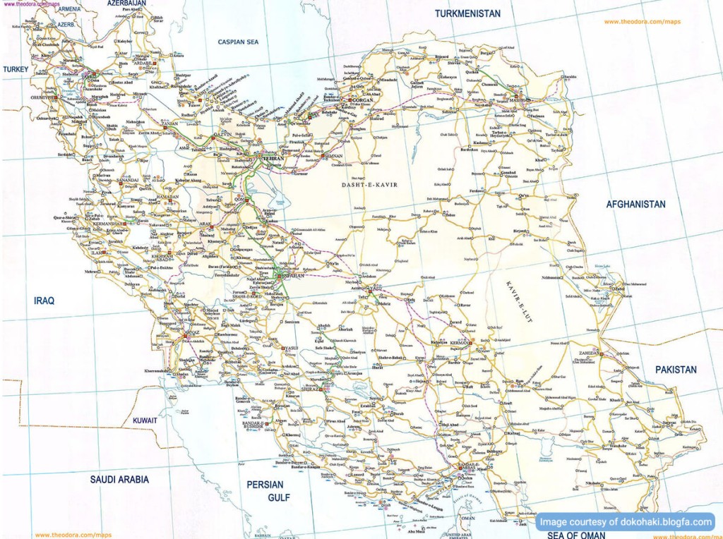
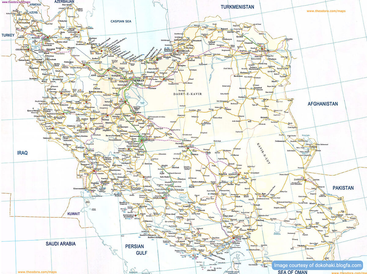
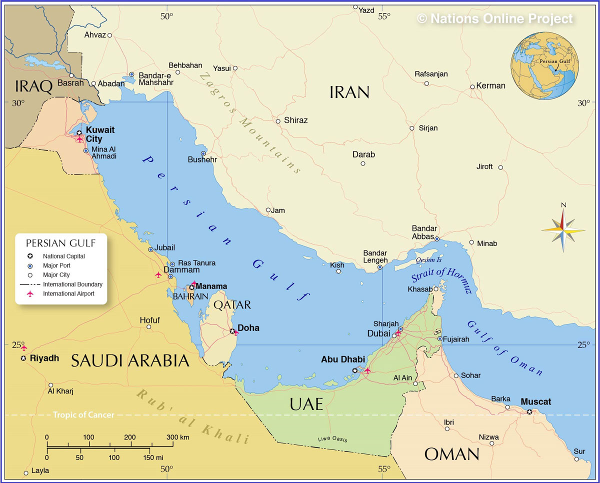
Iran is a country in southwestern Asia, located on the eastern side of the Persian Gulf. It lies at the easternmost edge of the geographic and cultural region known as the Middle East. To begin to know the geography of Iran better, let’s start with the neighbors of this country:
The neighbors of Iran are Armenia and Azerbaijan on the northwest, Turkmenistan on the northeast, Iraq, and Turkey on the west, Afghanistan, and Pakistan on the east.
Iran is the second largest country in the Middle East, after Saudi Arabia. It extends over a total area of 1,648,000 sq km. The country is almost triangle-shaped with its longest side extending from the border with Turkey in the northwest to the border with Pakistan in the southeast as long as 2,500 km.
More than half of Iran’s international border of 4,430 km is coastline, including 740 km along the Caspian Sea in the north and 1,700 km along the Persian Gulf and Oman Sea in the south. Bandar-e-Abbas is the largest harbor in the south of Iran located on the Strait of Hormoz, the narrow passage separating the Persian Gulf and Oman Sea through which tens of oil tankers are heading for various destinations in different corners of the world every day.
Iran Topography
The topography of the Iranian plateau is highly diversified and includes mountain ranges, basins, and desert areas. This topographical diversity has created a wide range of climates in Iran including humid subtropical, arid, cool and subhumid, and cold semiarid climates.
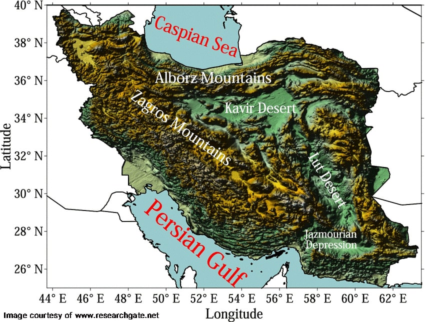
Topography of Iranian Mountain Ranges
The two most prominent mountain ranges in Iran are Alborz and Zagros.
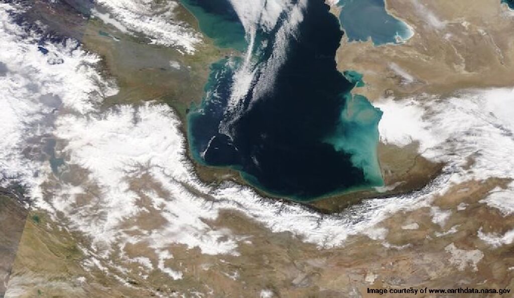
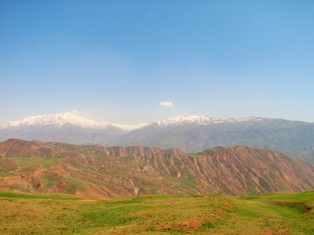
Alborz Mountains: It is located in the north of Iran along the Caspian Sea. Alborz mountain range is one of the reasons behind the humid climate of northern Iran, and the desert climate of central Iran. It houses the highest peak in Iran, Damavand, with an elevation of 5,671 meters and a prominence of 4,667 meters. It is the highest point in the Eurasian landmass in West Asia. A volcanic mountain that formed around 1.78 million years ago. The last volcanic activity in this mountain occurred during the Holocene period (5300 BCE).
There are 7073 named peaks in the Alborz Mountain range. The most significant peaks on the Alborz Mountain Range include Alam-Kuh (4,848 m), Sabalan (4,811 m), Takht-e Suleyman (4,659 m), Shaneh-Kuh (4,465 m), Siah Kaman (4,472 m), Kholeno (4,375 m), Azad Kuh (4,355 m), Sialan (4250 m), and Shah Alborz (4,200 m).
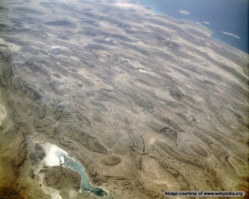
Zagros Mountains: Zagros mountain range is the largest mountain range in Iran, stretching from the northwest along the western borders of Iran and covering areas in Turkey and Iraq. This mountain range continues under the waters of the Persian Gulf into the Strait of Hormuz.
Zagros formed in the Miocene period due to the collision of the Eurasian and Arabian tectonic plates between 5-25 million years ago. The ongoing collision continues to lift the Iranian plateau and the mountain range.
This mountain range has three subranges, Dena, Zardkuh, and Oshtorankuh. The highest peaks in this range include Qash-Mastan (4409 m), Kale Qodveis (4341 m), Pazane Pir (4250 m), Kuh-e Dama (4216 m), Kolonchin (4221 m), Chegaleh (4134 m), and Haft Tanan (4104m).
Topography of Iranian Deserts
Deserts in Iran are unique ecosystems with diverse flora and fauna that have adapted to the harsh conditions of the wastelands. The ecoregion of Central Persian desert basins stretches from the Alborz mountains to the Zagros mountain range, and into northwest Afghanistan.
The two main deserts in this ecoregion include Dasht-e Kavir and Dasht-e Lut.
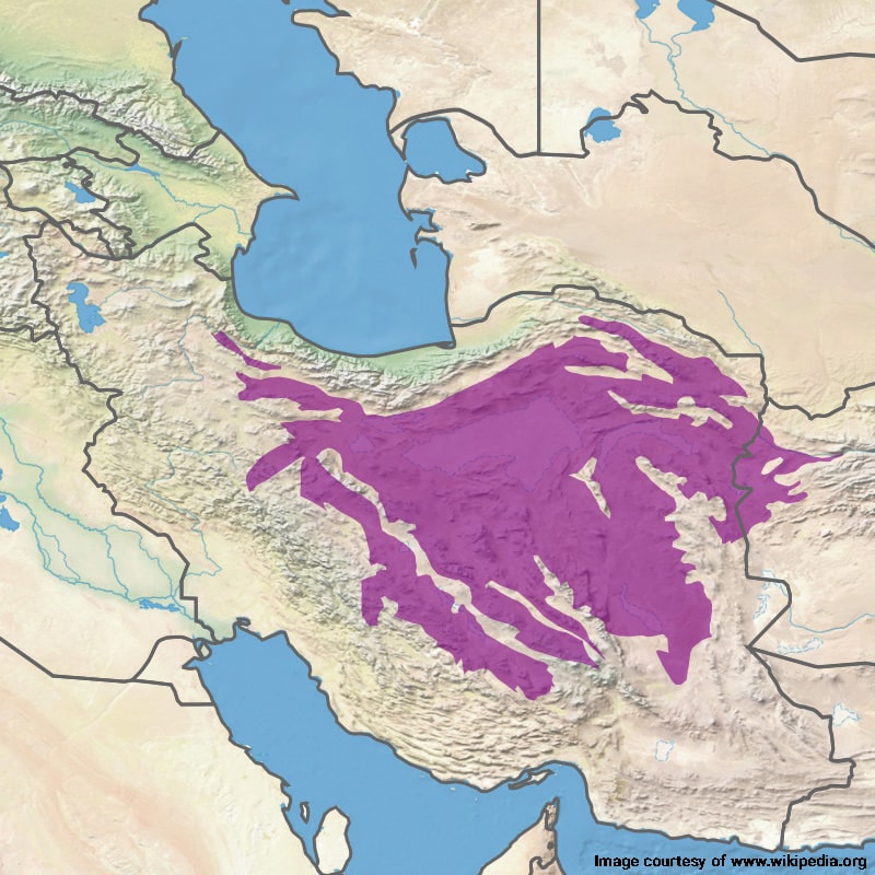
Dasht-e Kavir is the desert area north of the basin covering an area of 77,600 km2. It spreads across Khorasan, Semnan, Tehran, Isfahan, and Yazd provinces in Iran, and into Afghanistan. 3000 years ago, this desert was a series of lakes. Over time, it dried up and left a 6-7 km layer of sand on the surface.
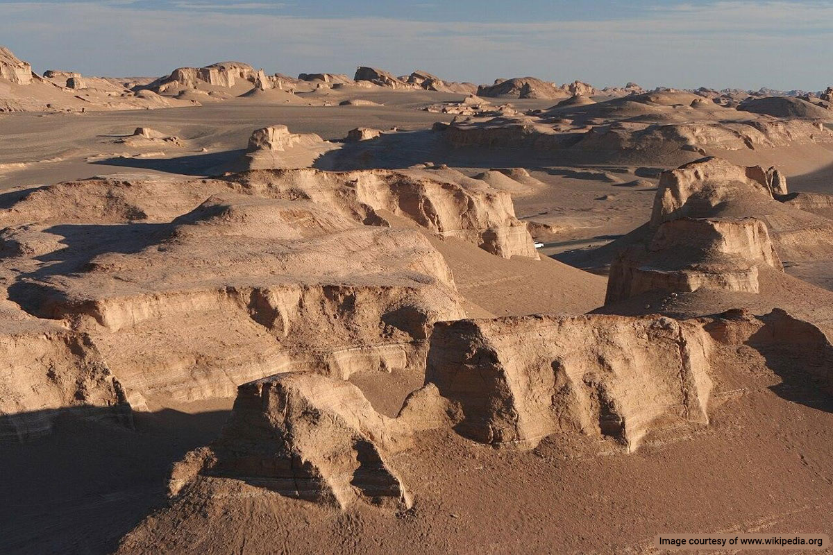
Dasht-e Lut is located in the southeast of the Central Persian basin with an area of 51,800 km2. This drainage basin dates back over 7000 years. Volcanic rocks cover over half of the desert’s surface. Dasht-e Lut holds the record for the hottest land surface on Earth as NASA satellites detected a surface temperature of 70.7 °C (159.3 °F).
Natural Regions in Geography of Iran
As one of the world’s most mountainous countries, Iran contains two major ranges of mountains, the Alborz with the highest peak in Asia west of the Himalayas, Damavand (5671 m above sea level) and the Zagros that cuts across the country for more than 1,600 km extending from northwest to the southeast of the country. The peaks exceeding 2,300 m in these two ranges capture a considerable amount of moisture coming either from the Caspian Sea southward or the Mediterranean eastward.
There are also some other local ranges. Within these mountainous rims lies a series of basins known collectively as the central plateau. They include Dasht-e-Kavir, a huge salt-encrusted desert in north central Iran, and Kavir-e-Lut, a sand-and-pebble desert in the southeast.
There are several fertile oases in these regions that are living examples of ancient Iranians’ determination to survive and bestow life to the arid areas.
When you study the geography of Iran, you will notice that there are numerous rivers in Iran, but nearly all of them are relatively short, shallow streams unsuitable for navigation. The country’s only navigable river, the Karun, flows through the city of Ahvaz in the southwest and empties to the Persian Gulf. Most rivers originate from the mountains and drain into the interior basins.
Although around 1/3 of Iran’s total territory is arable, only %10.4 is under cultivation. An additional %6 of the total land is used for pasture. Forested areas have declined slightly in recent decades and account for %4.5 of the total territory.
Natural Resources in Iran
Iran’s extensive petroleum and natural gas deposits are located primarily in the southwestern province of Khuzestan and in the Persian Gulf. Iran also has one of the world’s largest reserves of copper the deposits of which are located throughout the country, but the major lode lies in central Iran between the cities of Yazd and Kerman.
This region also serves as a center for the mining of bauxite, lead, zinc, iron ore and coal. Other coal mines operate throughout the Alborz Mountains. Iron ore mines also exist near Zanjan, near Mashhad and on Hormoz Island in the Strait of Hormoz. Iran also has valuable deposits of aluminum, chromites, manganese, gold, silver, tin and tungsten. There are also various gemstones like lapis lazuli, turquoise, amber, and agate.
Plants & Animals in Iran
More than 10,000 plant species have been identified in Iran. The natural vegetation in most of the country has been devastated and used for cultivating crops or feeding cattle. Natural forests at the Alborz consist of various trees like beech, oak, deciduous trees and conifers. There are wooded areas in some regions of higher elevation in the Zagros Mountains consisting primarily of oak.
Wild fruit trees grow in both the Alborz and Zagros mountains. They include almond, pear, pomegranate, and walnut. In the more arid central part of the country, wild pistachio and other resistant trees grow in areas that have not been disturbed by human activities. Tamarisk and other salt-tolerant bushes grow along the margins of the Dasht-e-Kavir.
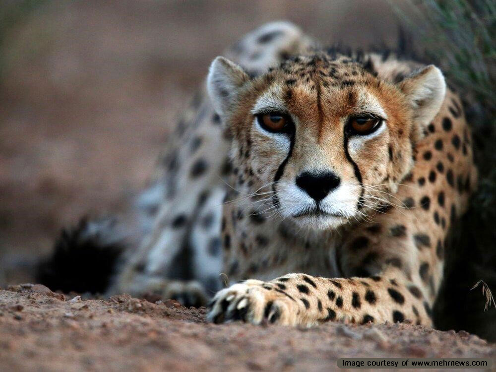
A wide variety of native mammals, reptiles, birds, and insects live in Iran. Many species of mammals-including wolves, foxes, bears, mountain goats, red mountain sheep, rabbits, and gerbils continue to thrive. Some species of birds inhabit Iran and a large number of the species are migratory birds that spend part of the year in other countries.
Population of Iran
The population of Iran was estimated to be at about 77,000,000 in 2013. This figure is more than double the 1975 population of 33,379,000. Between 1956 and 1986, Iran’s annual population growth rate was more than %3. It began to decline in the mid-1980s after the government initiated a major population control program. By 2001, the growth rate had declined to %0.7 per year. In 2006, the annual population growth rate reached 1.3% and the government has been persuading population growth since 2015. Approximately 55,500,000 people live in urban areas and 21,500,000 people live in countryside. This indicates a huge migration to the cities in recent years.
Iran’s population is made of numerous ethnic groups. Persians form %60, Azeris %25, Kurds %5 and Lurs % 2 of Iran’s inhabitants. The remainder of the population comprises small communities of Arabs, Armenians, Assyrians, Baluchies, etc. The country is almost entirely Muslim no matter which ethnic or linguistic group they belong to.
Climates in Iran
The totally different up and down altitudes of Iran are the major reasons for the several various climates. The Caspian coastal plain on the northern edge of the country with an average elevation of about the sea level remains humid all year round. Winter temperatures rarely fall below freezing point and maximum summer temperatures rarely exceed 29’C. Annual precipitation averages 650 mm in the eastern part of the plain (Mazandaran Province) and more than 1,900 mm in the western part (Gilan Province).
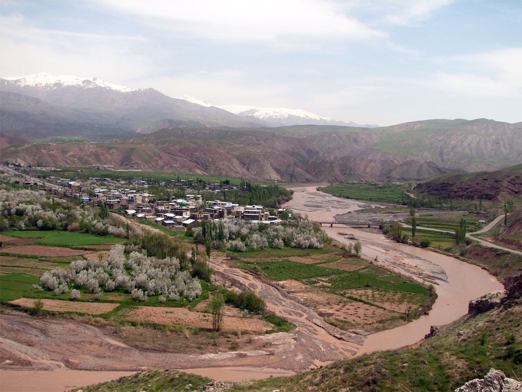
At higher elevations to the west, the inhabited areas in the Zagros Mountains experience lower temperatures with average daily temperatures below freezing point in winter. They also experience warm summers with the average temperature of 25 C in the northwest and 33 C in the central and southern Zagros. The average annual precipitation, including snowfall, is more than 280 mm at higher elevations.
The central plateau region also experiences regional variations. The arid basins of central and eastern Iran generally receive less than 200 mm of precipitation per year.
The southern coastal plains of Iran have mild winters with average January temperatures ranging from 7 C to 18 C in Khuzestan Province, but the average temperatures in Bandar-e-Abbas on the Strait of Hormoz are even higher. Summers are very hot and humid with temperatures exceeding 48 C during July in the interior areas. The Annual precipitation ranges in this region are from 145 mm to 355 mm.
Large Cities of Iran
The country’s capital and largest city, Tehran, serves as the main administrative, financial, industrial, commercial, educational and publishing center. Iran’s other major cities include Shiraz, Esfehan, Tabriz, Mashhad, and Ahvaz.
Shiraz is a manufacturing center in the south near the ruins of the most glorious ancient Persian monument called Persepolis.
Esfehan is a manufacturing center with several masterpieces of Islamic architecture from the 17th and 18th centuries.
Tabriz is the principal industrial and commercial center of the northwest.
Mashhad is a manufacturing and commercial center in the northeast and the site of the country’s most important religious shrine where the body of the eighth Imam of Shiites has been buried.
And Ahvaz is the major commercial and manufacturing center in the southwest of Iran.
Read more:




Thanks for making the article available. Regards.
You’re welcome. I’m happy it’s been of some use to you.