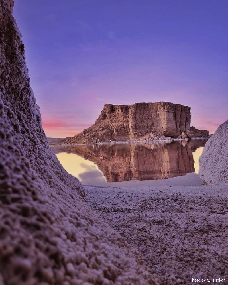
The name of Urmia Biosphere Reserve comes from the name of a lake located in the northwest of Iran. UNESCO has inscribed this natural attraction in its list of the Iranian biosphere reserves. According to the provincial divisions of Iran, the lake is located between West Azerbaijan and East Azerbaijan provinces. It is close to the city of Urmia.
Lake Urmia is the largest inland lake in Iran. The area of the lake was about 6,000 square kilometers in 1998. So it ranks the 25th in the world in terms of area. Lake Urmia Biosphere Reserve is the largest saltwater lake in the Middle East, and the 6th largest saltwater lake in the world.
Investigating the fluctuations of the water level of the lakes has become particularly important in recent years due to the importance, nature and position of these water bodies. The water in this lake is very salty. Zarineh Rood, Simineh Rood, Talkheh Rood, Gadar, Baranduz, Shahrchay, Nazlou and Zola rivers supply the water of Lake Urmia.
Historical Background of Lake Urmia Biosphere Reserve
Today, the name of this lake is Lake Urmia, extracted from the name of Urmia City, the capital of West Azerbaijan Province. In the 1930s, during the reign of Reza Shah, the name of this lake was “Rezaeieh” in Reza Shah’s honor. After the 1979 Revolution in Iran, the lake regained its former name, Lake Urmia.
In the Turkish language, this lake is called Urmu Gulu. Also in ancient Persian language, the name of this lake was Chichast meaning glowing. In the middle ages, the name of this lake was “Kabuda” (Kabdan).
We can find one of the earliest references to Lake Urmia Biosphere Reserve in an inscription of the 9th century BC (858- 824 BC). This inscription refers to two names at Lake Urmia. Also Persua (means Iranians or Persians) and Matai (or Mitani) are other names attributed to this body of water. It is not yet clear whether these names refer to the region, tribe or the link between a group of people’s names and the kings.
Lake Urmia Biosphere Reserve has been the center of The Mannaeans Kingdom. The likely territory of the Mannaeans was in Hassanloo Mound in the south of Lake Urmia. For the last five hundred years, Iranians, including Azerbaijanis and Kurdish people, have populated the areas around the lake.
Geographical and Natural Location of Lake Urmia Biosphere Reserve
Lake Urmia is one of the supersaturated salt lakes in the world. Urmia Lake Biosphere Reserve is 140 km long and 15 to 50 km wide and covers an area of 5,000 to 6,000 km2 (according to precipitation and evaporation).
The lake is located in wide low depth subduction with an average depth of 6 meters. However, its deepest point is 13 meters located in the northwest corner. Its surface is 1,300 meters above the international waters level. There are more than 102 islands in the lake that the shape and size correspond to the annual rainfall.
Among these small and large islands, Eslami Peninsula (Royal Peninsula) is the largest and it changes into an island during the years with high rainfall. The water basin area of the lake is about 50,000 km2.
Indicators of Water Basin of Urmia Lake Biosphere Reserve
Lake Urmia Biosphere Reserve is located northwest of the Iranian plateau. The water basin of Lake Urmia is 51,876 km2. That is equivalent to more than 3% of the total area of Iran. 60 rivers assuage the basin, 21 of which are permanent or seasonal, and 39 of them are periodic.
This basin is one of the valuable centers of agriculture and animal husbandry in Iran due to its plains such as Urmia, Tabriz, Azarshahr, Bukan, Bonab, Miandoab, Mahabad, Naqadeh, Salmas, Piranshahr, and Oshnavieh. The large reserve dam of Bukan has played a major role in preserving the lake so far.
The major ions present in Lake Urmia include Na+, K+, Ca2+, Li+, and Mg2+. The concentration of Na+ and Cl− in the Lake Urmia Biosphere Reserve is approximately four times more than that of the international waters. Sodium concentration in the southern part of the lake is slightly higher than in its northern part.
Flora of Lake Urmia Biosphere Reserve
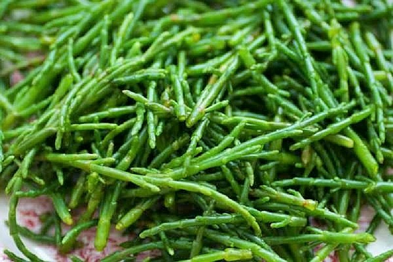
Flora of Lake Urmia ecosystem has two special vegetation types:
- The saltmarsh cover around the lake including a large area of the ecosystem of this biosphere reserve.
- The vegetation of the islands mainly found in Kabudan, Ask, Espir, Arezoo, and Eslami islands. There are 177 plant species and 174 island species identified around the lake. The largest plant family around the lake in this biosphere reserve belongs to Ateraceae family of 33 species, grasses family of 21 species. The largest genus belongs to Euphorbia and the wild fenugreek.
Among the plant families of Urmia Lake biosphere reserve, there are 12 families special and endemic of Iran.
The diversity of tree and shrub species in Ashk Island is denser than the lands around the lake. However, the weeds and salt-tolerant plants (halophytes) are denser around the lake than islands due to the large extent of saline soils.
Fauna of Lake Urmia Biosphere Reserve
Lake Urmia Biosphere Reserve is the habitat of 62 species of bacteria, 42 species of microscopic fungi, 20 species of algae, 311 species of plants, 5 species of bivalve mollusks (in the rivers of islands), 226 species of birds, 27 species of reptiles and amphibians, and 24 species of mammals.
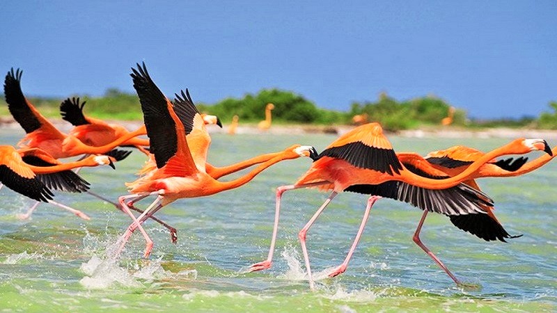
There are also at least 47 species of fossils found in this area. With more than a hundred small rocky islands, the lake is home to migratory birds, including flamingos, pelicans, spoonbills, ibises, storks, shelducks, avocets, stilts, and Laridae.
Due to the excessive salinity of the lake, no fish live there. However, Lake Urmia is one of the major habitats of Artemia, a genus of aquatic crustaceans. This crustacean is one of the main sources of feeding migratory birds, including flamingos.
Economic Value of Lake Urmia Biosphere Reserve
Exploration studies for salt extraction from Lake Urmia have shown that the total solid sedimentation of the lake reaches more than 5 billion tons. According to estimation, Potassium is about 27 million tons of K2O and about 60 million tons of potassium sulfate, magnesium is about 240 million, bromide is about 28 tons, and lithium is about 250 tons.
Therefore, after processing studies, it is possible to extract the salts of Lake Urmia by constructing solar evaporation ponds and processing plants.
Causes of Drying Up of Lake Urmia Biosphere Reserve
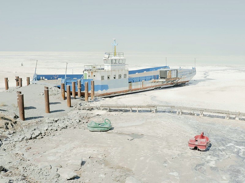
The lake has begun to dry up since 2006. Satellite imagery shows that the lake has lost about 88 percent of its area in 2015. There are many reasons for drying up of Lake Urmia:
• Drought, highway construction on the lake, and excessive use of the water basin of the lake as well as low snowfall and rainfall in recent years
Dangers of Drying Up of Lake Urmia Biosphere Reserve
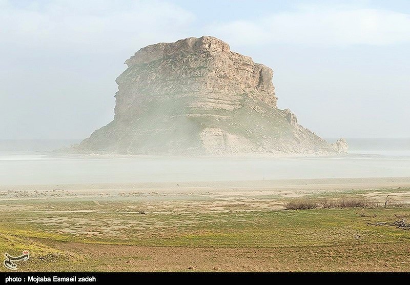
Some environmental experts predict that if the lake dries up, the temperate of the regional climate will change to a tropical climate with salt winds. The environment of the region will also change.
In addition to salt, many contaminants, including heavy toxic metals used in industry and toxic substances used in agriculture, have infiltrated into surface and subsurface waters associated with the lake. If the lake dries up, many of the aerobic toxins will pose the risks to the biomass and the local people.
The danger of drying up Lake Urmia threatens the lake up to its 500 km radius. Experts estimate that if the lake dries up, salt precipitation is expected in many neighboring provinces, leading to the displacement of 13 million people.
Repeated rainfalls restored Lake Urmia in 2019 and increased more than 90 cm in its height level.
Rescue Plans of Lake Urmia Biosphere Reserve
One of the plans to save Lake Urmia from drying up was the transfer of water from other water basins, including the Aras River. The water transfer of this river could have contributed to the filling of Lake Urmia.


