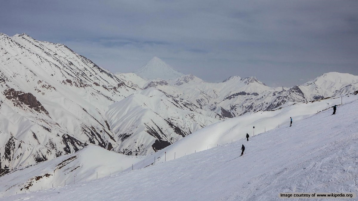
To explore the cultural landscape of Alamout, you have to scrutinize into the local customs, crafts, arts, religious and cultural traditions in Alamout area. Such topics have made Alamout a major tourist destination.
Alamout is one of the culturally rich areas of Iran. It’s a county of Qazvin Province located geographically between two mountain ranges.
As part of Alborz Mountains enclose Alamout, there are many rivers flowing into the region. Meanwhile, there are mineral and therapeutic springs regarded as important tourist attractions.
Furthermore, Alamout castles are in fact the major archaeological heritage of the region. These castles were the propagation site of the Ismaili religious branch led by Hassan Sabbah and his fervent followers. Rock monuments and tombs are the other attractions of the area. The deep belief roots of the pre-Islamic cultural customs, such as the Zoroastrianism and Mazdakism, are the heritage of past eras profoundly hidden in the local culture.
Geography of Alamout
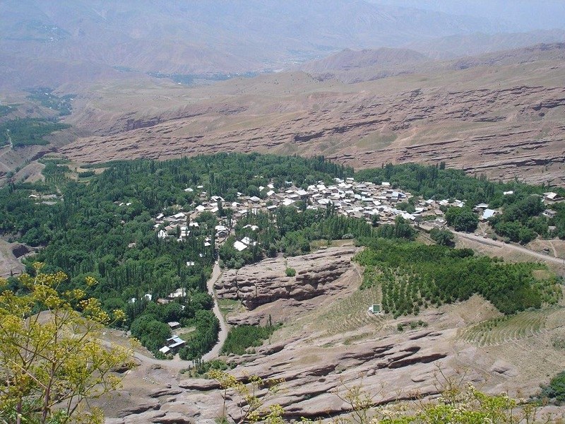
Alamout is located north of Qazvin and is a mountainous region, enclosed among the mountains of Alamout and Taleqan and Alamout Valley. It is limited from the north to Mazandaran and Ramsar, from the south to the Taleqan and Abyek mountains, from the southwest to Qazvin, from the west to Abhar and Tarom-e Sofla and from the east to Roudbar-e Zeytoon County.
This mountainous land, that all of its parts are located in the highlands of Alborz, has an area of 1,919 km2.
Part of Alamout Region located on the margins of Shahrud Valley is warmer than the foothills and its heights. Although these areas are very close together and there is not much distance between the two climatic conditions, there is a significant change in temperature. The foothill area is very cold and snowy in winter and cool in summer, and the area near Shahrud has warmer weather in winter and summer. The average annual temperature of Alamout is 5.5˚C and the average annual rainfall is 405 mm.
The villages of Alamout are composed of houses with an indigenous architecture of sun-dried bricks, rubble trench, and cob and in steppe form.
Population and Economy of Alamout Region
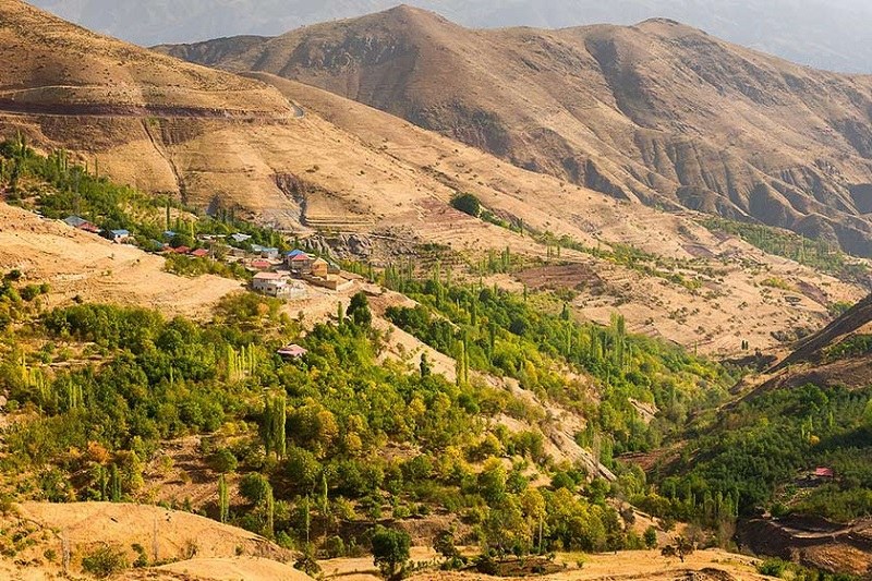
According to the 2006 Iranian census, the population of the Alamout was equal to 121,886. The local people are Gilaks and speak the Gilaki language.
Agriculture and animal husbandry are the main occupations of local people. In addition, the tourist industry is relatively good in the region.
The art and handicrafts are the other parts of the economy of Alamout Region.
Alamout Arts and Crafts
A profound study of the cultural landscape of Alamout is incomplete without exploring the lifestyle of its inhabitants. villagers have been engaged in traditional arts to meet their daily needs. The house workshops are the creation site of a variety of arts and applied industries.
In the past, every housewife of Alamout was an artist able to meet the needs of the home and played a constructive and effective role with her husband in the home and community.
The basic resources needed for handicrafts in Alamout are available in the village and the villagers have no need to go out of Alamout area. Keeping livestock is a key economic factor explaining the main source of Alamout handicrafts. Villagers use animal wool for the production of rugs, carpets, and clothing.
The villagers in this area are engaged in handicrafts such as weaving carpet, Kilim, and tents in various designs with natural colors gaining from the plants found at the mountains and valleys of Alamout.
Weaving textile, tent, Izar (or bread cloth), Sof Bafi and Pan Bafi (a sort of textile weaving), Jajim (a sort of rug), Jel Bafi (a sort of rug weaving), Giveh (a sort of traditional shoes), socks, and felting are among the handicrafts of the region.
History of Alamout Region
Alamout is the name of a part of the Roudbar-e Alamout region. In addition, it is the name of a castle in the area. Alamout is a Persian word derived from the ancient word of “Aleh Amout”. Aleh meant “eagle” and Amout meant “learning and training” in ancient Persian language. According to this concept, we can conclude that eagles have nested in the highest mountains of Alamout.
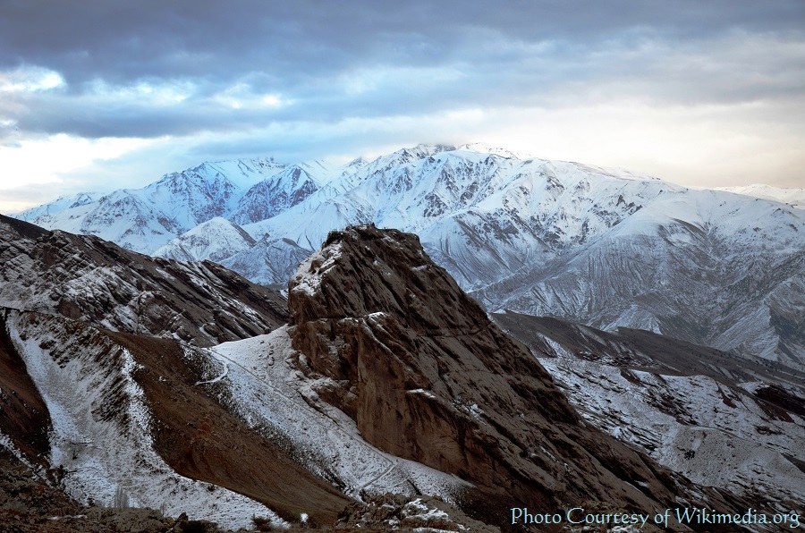
Alamout Castle is currently located in the mountainous Alamout Region. However, the whole region, known today as Roudbar-e Alamout, was called Roudbar in the past. Roudbar in Persian means a place where there are many rivers. All the rivers flow into Shahrud, the main river passing through Roudbar region. That is why the local people call the region “Roudbar-e Shahrud”.
From the pre-Islamic period to the reign of the Seljukid era, Roudbar-e Shahrud was part of Deylam Region. It was sometimes the main capital of the Deylamite dynasty and sometimes a part of the territories under their rule.
During the reign of the Ismailistes in Roudbar-e Shahrud, Alamout Castle gained so much reputation that local people called part of this area after the name of this castle. The historic Alamout Castle made Roudbar-e Shahrood region famous as Roudbar-e Alamout.
Historic Attractions of Alamout
1. Alamout Castle
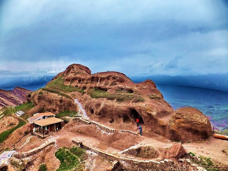
Alamout Castle is one of the unique historical castles in Iran. Its name equals what the assassins had accomplished in response to the foreign invaders to Iran.
The castle is located in the northeast of Gazorkhan Village (Gazor Khan) and above a cliff of an altitude of 2,163 meters above sea level. The height of the cliff is 220 meters from the foothill adjacent to it.
1.1 Alamout Castle Sovereignty
Hamdollah Mostofi, a Persian historian, said that Mohammad Ibn Zayd constructed the castle and then, Hassan Sabah seized it in 1093 AD. Today, another name of the castle is the Fortress of Hasan Sabah. The major reason for the castle’s reputation was due to the military and security activities of Hasan Sabbah.
He had turned into a legendary character. The Seljuk rulers had become helpless because of his resolute determination to resist them.
He had planned the water management system for the people in the area. Before him, the villages in the area had suffered from stinky water and sewage system. He had fixed the issue for them. He had even created a rich library for the scholars of his time at his fortress. His popularity had grown due to his great contributions to the local people there.
1.2 Castle Architecture
To learn more about the cultural landscape of Alamout, we need to study the architecture of its most prominent monument.
The cliff is located on the southwestern foothills of Houdkan Mountains. According to Ata Malak Joveyni, a Persian historian of the 7th century, when you look to this tall cliff from the northeastern side, it looks like a sleeping camel. According to Freya Stark, an Anglo-Italian explorer, and travel writer, the upper side of the cliff resembles a ship whose nose is extended toward the northwest.
The castle consists of two parts on the east and west. Each of them includes the lower castle and the upper castle.
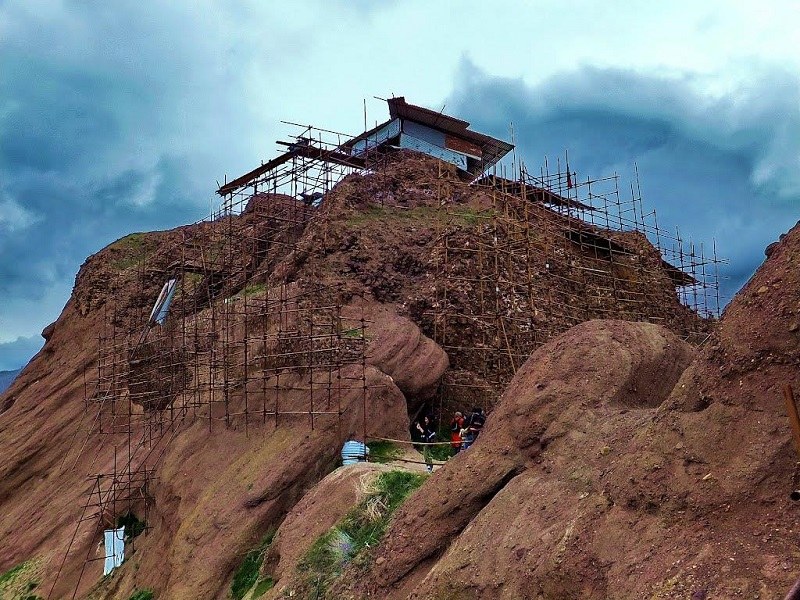
The length of the castle is about 120 meters and its width varies from 10 to 35 meters in different locations. The eastern wall of the upper castle or the large castle is made of stone and plaster. It’s in better condition compared to the other parts. It’s about 10 meters long and between 4 and 5 meters high. On the south side, there is a small room carved inside a rock that used to be served as a guardian room.
On the eastern side of this room, there is a 2-meter-high wall. On the northwest side of the upper castle, there are two rooms carved into the mountains. In the first room, there is a small water hole that gets rejuvenated if it drains out of the water. At the foot of this room, there is the northern wall of the castle measuring 12 meters long and 1 meter wide. This wall is located on the lower level of the castle and has a dreadful precipice.
On the southwest side of this part of the castle, there is a pond, which is 8 meters long and 5 meters wide carved in a rock. This pond used to be a water reservoir and can still get full of water due to the seasonal rainfall.
At the southwest corner of this pond, you can see an old vine tree that is still green. The local people believe that Hasan Sabah planted the old tree. This part of the castle is likely to be the place where Hassan Sabah stayed for 35 years and led his disciples.
The guardians of the castle and their families resided on the eastern side of the castle. Now, there has remained just a little part of the southern wall. On the northern side of this wall, there are 10 mangers for livestock carved into the rocks. The western wall of this part has remained with a height of 2 meters, but the eastern wall is destroyed.
Between the two parts of the castle, the upper and lower castle, there is a square space surrounded by a wall, dividing the castle court into two parts. Today, there are traces of rock and soil on the square, which are undoubtedly the remains of the many buildings that existed once in this place.
1.3. Defensive Facilities of Alamout Castle
The only way to enter the Alamout castle is located at the end of the northeastern side, a few meters below the eastern tower of the castle. In the southern foothills of the castle, there is a gutter approximately 50 meters long and 2 meters wide. It is full of water originating from the inside of the castle. Therefore, there is no way of penetrating to the castle from this part.
When you study the lifestyle and everyday lives of the inhabitants of this area, you understand that the defensive facilities of this fortress resemble the cultural landscape of Alamout.
1.4. Destruction of the Castle
The end of this legendary castle came when the Mongols invaded Iran. Hulagu Khan, a Mongol ruler who conquered much of Western Asia, ordered his soldiers to burn down and destroy the castle in 1256.
The historical texts mentioned that Alamout castle was a prison during the Safavid period. However, archaeological studies show that Alamout castle was not only a prison but also it was the settlement of people at that time.
Unfortunately, the excavations carried out during the Qajar period by non-experts and in pursuit of the so-called treasures in Alamout Castle, have damaged this historical castle.
You can learn more about Alamout Castle here!
2. Noizar Shah
There are several fortresses and strongholds representing the cultural landscape of Alamout area. Here’s another one:
This ancient castle was built on the north of Garmaroud Village. It was a strong and invincible castle. The walls, rooms, and reservoirs of this castle have remained.
3. Lambsar Castle
Lambsar is located three kilometers northeast of Razmiyan City and is the strongest and largest castle in Alamout Region. The history of this castle dates back to the pre-Islamic era.
4. Shirkouh Castle
Shirkouh Castle is located at the intersection of Alamout River and Taleqan River. It is located near Baqdasht Village. This castle was a place to confront invaders. The deep valleys around the castle, the high watchtowers, the eight large reservoirs of water supply, and the grand rocky oven are the features of Shirkouh Castle.
5. Hassan Abad Rocky Tomb and Pij Bon Rocky Caravanserai
These two monuments are among the major heritage monuments of Alamout Region. Hassan Abad Rocky Tomb, belonging to the Sassanid period, is located over a mound overlooking Hassan Abad Village. Pij Bon Rocky Caravanserai dates back to the Safavid era and is located near the last village of Alamout and in the old Qazvin to Tonekabon road.
6. Imamzadeh Zar Abad
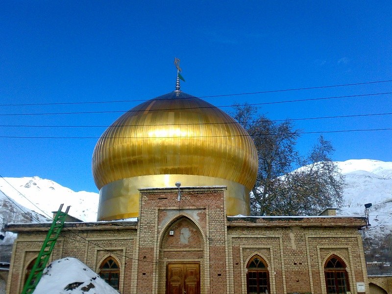
To explore the cultural landscape of Alamout area, you need to know about other monuments too. Here’s a wel-known shrine:
Zarabad Village, where the shrine of Imamzadeh Ali Asqar is located, is one of the largest villages of the Roudbar-e Alamout Area. The village is located about 81 km from Qazvin City. This village is famous especially because of the shrine of Imamzadeh Ali Asqar.
This place is famous among villagers because of a plane tree located in the courtyard of Imamzadeh. They believe that it bleeds on Ashura day. Every year, many people go to Imamzadeh Ali Asqar in Ashura to visit this plane tree.
Other historical attractions of Alamout include Shams Kelayeh Castle in the north of Shams Kelayeh City and Qostin Lar Castle in the west of Qostin Lar Village that each one has its particular beauty of the landscape.
The Natural Landscape of Alamout
In addition to plant species, there are various animal species around Ovan Lake. The goats, brown bears, foxes, jackals, wolves, hogs, wild cats, eagles, hawks, owls, quails, rollers, woodpeckers, turtles, crabs and fishes are the animal living in Alamout.
• Ovan Lake
Alamout has many natural attractions that the most famous is Ovan Lake.
If you take Qazvin to Alamout road, which is a spectacular and lush path with a beautiful but dangerous mountain pass, and passes through Rajaei Dasht, it takes about 3 hours to reach a dilemma that one of them arrive at Alamout and the other reach to Ovan Lake.
This beautiful lake of about seven acres is located 70 km of Qazvin. It is located in the middle of the four villages of Ovan, Varbon, Zavardasht, and Zarabad.
Ovan Lake, with an area of 70,000 square meters, is located at an altitude of 1,815 meters above sea level. The landscape of this lake attracts many tourists.
• Wildlife and Vegetation
The numerous plant species along the lake have created a beautiful natural landscape that is one of the main factors of the attractiveness of the area.
Except for seedling tree species such as willow, plane tree, poplar, apple, cherry, hazelnuts and walnut, there are herbaceous plants such as milkvetch, spear thistle, and licorice exist near Ovan Lake.
In addition to plant species, there are various animal species around Ovan Lake. The goats, brown bears, foxes, jackals, wolves, hogs, wild cats, eagles, hawks, owls, quails, rollers, woodpeckers, turtles, crabs and fishes are the animal living in Alamout.
The above list is just to introduce the natural landscape of Alamout and what can be found there.
• Seven Old Trees
Iranian National Heritage Organization has inscribed five old planed trees of the city of Razmiyan City and two old berry trees of Safareyn Village in the National Heritage List.
The plane trees are 400 to 650 years old and the berry trees are 250 years old.
The Region as a Magnet
The natural and cultural landscape of Alamout is a magnet for tourism by itself. Just consider what was mentioned above. It’s quite clear that there’s huge potential for tourism in the area. Every year, lots of Iranian and international travelers visit Alamout area, learn a lot about it and enjoy their visits.


